


Next: 3.3 Components of a climate model Up: 3.2 A hierarchy of models Previous: 3.2.2 Intermediate complexity models
3.2.3 General circulation models
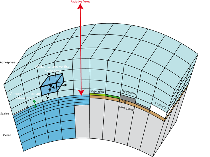
General circulation models provide the most precise and complex description of the climate system. Currently, their grid resolution is typically of the order of 100 to 200 km. As a consequence, compared to EMICs (which have a grid resolution between 300 km and thousands of kilometres), they provide much more detailed information on a regional scale. A few years ago, GCMs only included a representation of the atmosphere, the land surface, sometimes the ocean circulation, and a very simplified version of the sea ice. Nowadays, GCMs take more and more components into account, and many new models now also include sophisticated models of the sea ice, the carbon cycle, ice sheet dynamics and even atmospheric chemistry (Fig. 3.5).
|
Because of the large number of processes included and their relatively high resolution, GCM simulations require a large amount of computer time. For instance, an experiment covering one century typically takes several weeks to run on the fastest computers. As computing power increases, longer simulations with a higher resolution become affordable, providing more regional details than the previous generation of models.